
An Inver Grove Heights Street Search, Step by Step
Street research works best as an address trail, not as a list of names. Dakota County keeps the clearest public starting point in its property map, while the City of Inver Grove Heights keeps a separate property and permit locator. Each source has a narrower role. The parcel system can identify an owner of record and describe land. The city locator can confirm an existing city location. A registration form can confirm a known person at a known address. None of those results alone proves every person who lives on the street.
- Enter the street address in Dakota County Property Information. The public map accepts an address or Parcel ID, not an owner-name search. Select the matching parcel rather than assuming the first suggestion is correct.
- Record the selected owner and mailing address, legal or tax description, municipality, and Parcel ID. Check its tax and building panels for the parcel facts that help distinguish one address from another.
- Use CityView with the property-address autocomplete or Parcel Number to confirm that the location is in the city system. This is an address check, not a public occupant roster.
- Take the owner or legal description to RecordEASE. After account access, follow the grantor and grantee chain from a purchase deed, preserving document references and party roles.
- Use MNVotes only when you already have a full name, date of birth, and address match. Its form confirms a known registration; it does not provide a bulk roster for a street.
- For an older address trail, compare the documented telephone-directory runs and regional directories under Inver Grove, Invergrove, township, village, and postal-community names. A subscriber entry is evidence to check, not proof of every household member.
That sequence keeps the street directory focused on the question each record can actually answer. It also leaves a durable research note: address, PID, legal description, record date, and the source that supplied each fact.
Inver Grove Heights Parcel Search Fields
Property Information is the primary street-by-street tool for Inver Grove Heights because its search begins with a full or partial street address or Parcel ID. Address results may be selected from matches. The county help material describes three selected-parcel panels: Property Information, Tax Information, and Building Information. A pending new parcel can be incomplete, so the result should be read as a current county record, not an all-time account of the address.
| Search or result field | How Dakota County presents it |
|---|---|
| Parcel ID | Text search; dashes are optional in the county help instructions. |
| Street address | Full or partial address, a house number, or a street can return a selectable match. |
| Property panel | May show owner, owner mailing address, municipality, tax description, school district, and watershed district. |
| Tax panel | May show current and prior-year taxes, special assessments, and homestead status. |
| Building panel | May show year built, bedrooms, bathrooms, and square footage. |
| Map tools | Parcel geometry, layers, print/export, tax links, and subdivision-plat links can support the address record. |
Insider tip: The map can expose an owner mailing address after parcel selection, but the inspected public interface did not expose a search field for an owner name. Start from the street address or Parcel ID. If the question begins with a person, use a properly matched record or a custodian route rather than forcing a name into the property map.
Inver Grove Heights Mailing Address Myth
An owner mailing address and a situs address are not interchangeable. The situs address is the physical property location. A tax roll can send notices to an owner at another street, city, or state. That mailing address may be useful for following the county record, but it does not establish where the owner stays or whether the parcel is occupied by that owner.
Keep both fields when building a street directory note, along with the municipality and legal description. Homestead is also a tax classification or claimed use signal, not conclusive proof of occupancy. The distinction matters when an address has multiple owners, a trust, a business entity, or an address-protection rule.
Note: Treat each address field as a labeled record fact, not as a substitute for a verified current residence.
Inver Grove Heights CityView Address Check
The public CityView locator adds the municipal layer to a street search. Its visible control is Property Address*, an autocomplete field. Begin typing a street address or use a Parcel Number, then select an existing location in the jurisdiction. The returned location can help connect the street directory to city property or permit context without making a claim about a present resident.
The CityView property locator shows the address-first route used for this check.
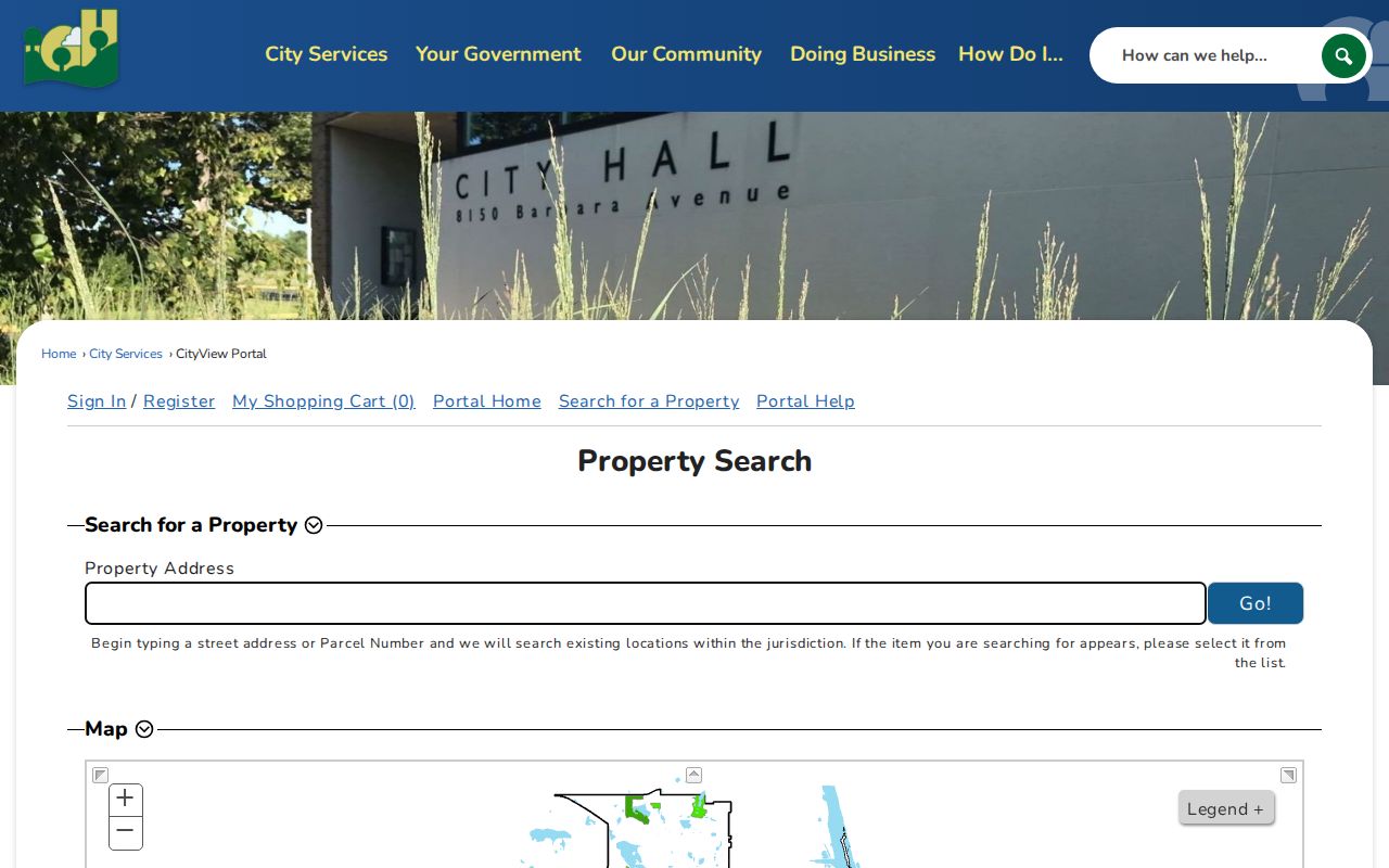
Applications and uploads require sign-in or registration. The public screen does not promise complete historic permit coverage, an owner-name search, or a streetwide resident list. For an unavailable record, the city permits and inspections department and the city data-request route are more appropriate than a guess from a blank locator result.
Inver Grove Heights Deed Chain by Address
A property address becomes a land-record trail when it is paired with the current owner and legal description. In RecordEASE, the buyer on a purchase deed is the grantee and the seller is the grantor. Record the document type, recording date, document number, book or Torrens reference, and legal description. Then search the seller as the next grantee to move backward through an earlier conveyance. Names can vary by initials, marriage, trust, or entity, so retain them as indexed.
RecordEASE has an account and payment gateway. Dakota County documents abstract-index material from July 8, 1993, while older deed books and counter research remain important. The post-login search fields were not publicly inspectable, so a street directory should not promise a free document-image or particular dropdown search. When the online route stops, request older book or document research through the county, use the counter, or seek a county copy by mail.
The county's recorded-document request route accepts a written request addressed to Property Taxation & Records, Attn: Research, 1590 Highway 55, Hastings, MN 55033. Call 651-438-4597 to verify cost; the county says requests allow about 24 hours and warns about private deed-copy solicitations that charge much more.
Dakota County Property Watch is the opposite time direction: a free signup by name, entity, or property for future recordings. Its alerts identify a matched party, recorded date, document number, and document type. It is helpful for watching later activity, not for reconstructing a historical street directory.
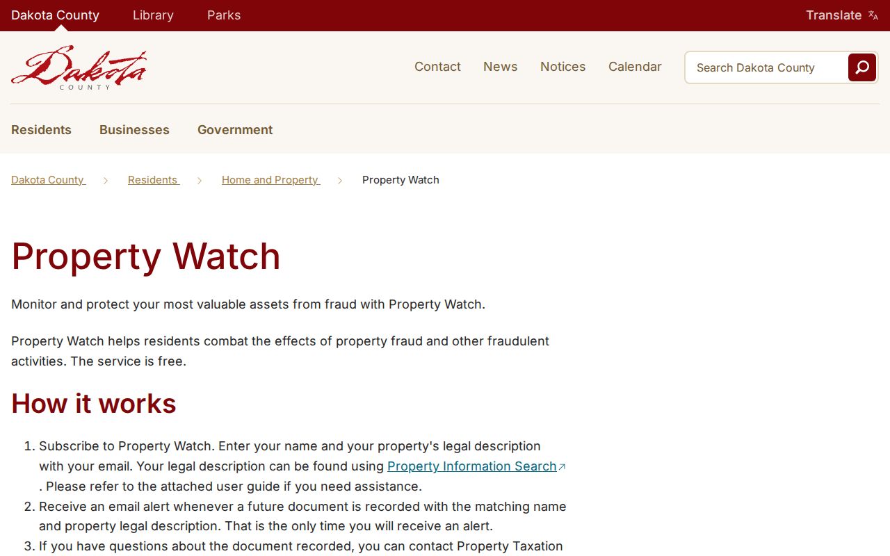
Use Property Watch after the address dossier is stable. It does not replace the grantor-grantee chain, the county's paid or request channels, or a careful check of the recorded document itself.
Older Inver Grove Heights Street Records
Current maps do not settle an older address question. Dakota County tax statements offer the current year and three prior years when searched by house number or Property ID, with ownership, property and legal address, tax breakdown, and special assessments. For a deeper history, use the legal description and deeds, then check the historical-directory collections rather than assuming a current number has always carried the same context.
The documented telephone-directory series includes Inver Grove runs from 1957 through 1964 and 1966 through 1989. Search the historical variants Inver Grove and Invergrove, plus township, village, and regional labels. The local collection has a documented 1965 gap, not proof that no directory ever existed. The historical shelf is described in the Inver Grove Heights city directories collection, where a reader can choose the right print, fiche, archive, or research-service path.
MNVotes for a Known Inver Grove Heights Address
MNVotes is an identity-and-address confirmation form, not an open street roster. It asks for first name, last name, month, day, and year of birth, then lets a user choose ZIP Code or County mode. The form also requires city or township, house number, and street. A separate apartment or unit checkbox makes the unit field required only when it applies.
Use the result only after matching the full name, date of birth, and address already in hand. Registration data are updated nightly, though election officials may need time to process a registration. A blank screen can reflect a mismatch, a recent change, or a protected voter. Minnesota Statutes section 201.091 limits voter data and controls the separate certified voter-list request process.
Note: A confirmed registration is a current clue for one person and address, not evidence for every resident on a street.
Inver Grove Heights Street Record Sets
Different address-keyed records answer different questions. Use the public parcel map to orient the street, tax statements for a short recent tax window, CityView for a municipal location check, and the recorder route for land documents. The table preserves the limits that keep a street directory from turning an address into a claim about every person associated with it.
| Address-keyed record | Keeper | What it can show | Access route |
|---|---|---|---|
| Parcel GIS | Dakota County | Boundary, PID, owner and mailing data, legal description, and layers | Public address or PID search |
| Tax statement | Dakota County Property Taxation & Records | Ownership, legal and property address, taxes, special assessments, and current plus three prior years | House number or Property ID online; county contact |
| Recorded land document | Dakota County recorder | Grantor, grantee, document type, date, number, and legal-description trail | RecordEASE account/payment, mail request, or counter |
| Plat or subdivision | County GIS and recorder | Lot, block, subdivision name, and address-to-legal bridge | GIS links, map catalog, or recorder |
| Building permit | City of Inver Grove Heights | Addressed permit or property-location activity where available | CityView; application detail and uploads have sign-in limits |
| Code record | City of Inver Grove Heights | Addressed report or violation context | RequestTracker and city code route; detail limits apply |
For map context, the Dakota County map catalog can search by city, section, grid, address, or PIN and lets a user choose a map type. Those layers help place the parcel. They do not replace the recorded deed or establish who occupies a location.
Inver Grove Heights Address Terms
A few records terms make address research easier to read. The parcel and legal description are especially useful when an address appears in different forms across county, city, tax, and historical material. Copy the terms exactly as the custodian displays them, because an informal shorthand can break a later deed or map search.
- Parcel
- A defined piece of land in the county system, usually identified with a Parcel ID or PID.
- Situs address
- The physical property location. It is distinct from the tax-roll mailing address for an owner.
- Plat
- A recorded map that lays out a subdivision, lots, blocks, and related land descriptions.
- Criss-cross directory
- An address-oriented directory arrangement that can help connect an address to a listed subscriber. Availability for a particular Inver Grove Heights year must be confirmed with the collection holder.
Inver Grove Heights Street Geography
Inver Grove Heights research crosses three physical record stops. City Hall holds municipal contacts and CityView activity in Inver Grove Heights. County Property Taxation & Records, the recorder route, and the Judicial Center are in Hastings. The Dakota County Historical Society research library is in South St. Paul. That geography explains why a complete street directory trail rarely comes from one counter.
City and state mapping material shows numbered streets as well as Cahill, Concord, and Rich Valley corridors. No official source reviewed verified an Inver Grove Heights renumbering, road-renaming, annexation, or address-conversion year. Do not invent one. When an older result seems inconsistent, bridge it with the plat, legal description, city archive, deeds, and historical locality names rather than assuming the street was renumbered.
Postal labels add another layer. ZIP Codes 55076 and 55077 are routing clues, not city limits. Validate a particular delivery address with USPS before using a postal label to reconcile a county or city record.
Limits of Inver Grove Heights Street Searches
There is no verified public, complete roster of all people on an Inver Grove Heights street. Property records identify land ownership and mailing fields, not every occupant. CityView is keyed to a property location. MNVotes confirms a known registration through a precise form. Protected addresses, Safe at Home participation, record classifications, delayed updates, and plain mismatches can all produce a limited or blank result.
Verify important details with the office that holds the record, preserve the retrieval date, and avoid publishing protected or sensitive information. A street-level record trail is strongest when it stays within those limits.